Saturday, July 9, 2011

Rollercoaster Weather

This is what I call roller coaster weather, that is nice then yucky then nice then yucky.  That is compliments to yet again a fairly zonal west to east jet stream that allows for the changing of air masses on a rather regular basis.  But it is summer and that jet will pull further north keeping us in the "stickys" once our next cool and dry shot comes through Wed-Thurs of next week.  Below is the water vapor image that shows our nice Sat-Sun and our frontal passage Tuesday afternoon bringing in nice O Canada air for the middle and end of next week.
The dark area over the eastern lakes and PA this morning (Red area) clearly shows dry air in the mid and upper levels.  Hence, as I am typing this I see no clouds this beautiful Saturday morning.  On my morning jaunt, I certainly felt the air have a slightly drier quality as I my T-shirt was only 3/4 saturated as opposed to completely saturated earlier in the week.  Now, it will still get warm today and most certainly Sunday, but the humidity should remain in check until late Sunday when the air begins to invade from the SW as shown by the green arrow above.  Not only will this spike the heat, it will most certainly spike the humidity as well.  The 500 mb prog for Monday shows the heat ridge building towards us for Monday and early Tuesday until the cold front invades from the northern plains.
As you can see above, the 588 mb height is north of PA which suggests temps will be quite warm for Sunday afternoon and Monday afternoon as well.  The real heat this week will be centered over MO, AR, OK, and KS where 100+ heat will be easily attained.  But by Thursday, look how the 500 mb level has evolved.  A rather strong front has squashed the 500 mb heights way down indicating cooler and drier weather for Wed-Thursday.  Note how the 594mb height has disappeared from the central US.  Oh, it will still be hot, but not as torrid as earlier in the week.  A refreshing NW flow at the mid-levels for us will lead to a nice couple of days for mid July. 
But, sure enough, the heat will return as shown by the ensembles for Monday, July 18.  The greatest anomaly is over the Great Lake states, but that is when we here in Harrisburg can also have some very hot temps as the winds downslope from the Appalachians and the air that is downsloping, warming, and compressing is already flippin' hot to begin with!  I look for our hottest (in absolute terms, not heat index with the humidity) weather of the summer the week of July 18.  That's not really any surprise since climatologically this is when we have our hottest weather at KMDT.  The Euro is on the left; the GFS on the right.  Note yet again a trough very near us and the persistent NW flow at the mid-levels.  We've been in this pattern since the 2nd week of June!
In closing, I have a brief survey for y'all to take if you'd be so kind.  Of course it has to do with Derek Jeter and his 3,000th hit.  So, please indulge me and log onto the link and take survey.  For my technologically challenged friends, acquaintances, and readers,...just bag it, it's not worth the hassle or frustration.

http://www.surveymonkey.com/s/29ZDXZ9


As for the weather; enjoy this nice but warm-hot respite from the humidity today and Sunday for it will be coming back in spades before the mid-week break or refreshing air invades from O Canada!

Happy week's end!

Smitty

AA:  Nice warm/hot weekend but with less humidity.  Hot & Humid for Monday and Tuesday until the front comes through with some possibly hefty storms Tuesday pm.  Nice and refreshing Wed-Thursday.

Thursday, July 7, 2011

Showers to Mark Changing of Air Masses

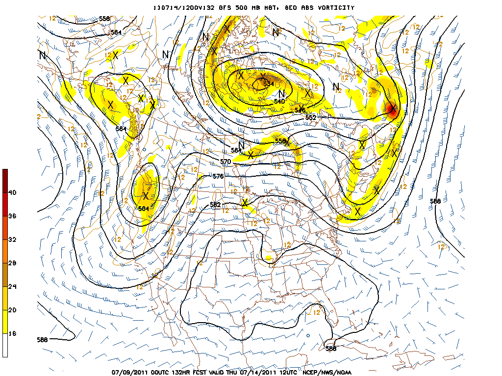
As has been the case for the last several days, we here in southern PA have been very close to a boundary in the atmosphere.  Just to our north, the air has been reasonably dry for the mid summer month of July.  However, from our area and points south, the air has had mid summer humidity which is typical and normal for us living here in the sub-tropics of southern PA.  The modeling is suggesting storms will fire this afternoon in a much more vigorous fashion than tomorrow afternoon.  However, as seen in the water vapor image below, the atmosphere may have trouble firing the convection as robustly as the models indicate.  Remember that the black areas are dry in the mid and upper levels of the atmosphere.
Here is the modeling for the rainfall for Thursday:
And the modeling for Friday afternoon.  Both of these maps show the 3 hour total of precipitation with the above ending 11 pm Thursday and the one below ending 5 pm Friday.  Clearly, Friday would tend to have a greater coverage of storms, but Thursday's model indicates the potential for heavier rainfall.  Either way, we sure could use some of these beneficial showers and thundershowers.
By Saturday, the winds are depicted on the modeling to be flowing directly from the north.  This will bring in much drier air again at the surface and also at the mid and upper levels as well. 
 By Sunday the high pressure system that is responsible for this northerly flow will be centered over God's Country, PA, aka Potter County. You can see this on the map below where the winds are diverging from the center of the high pressure system.  This will provide for sunny and very warm conditions over all of the state on Sunday.  By Monday, this high will move offshore and allow for a more humid flow from the SW.  So enjoy the brief respite of the humidity this weekend.
In closing, baseball fans across America will have their eyes and ears tuned to Yankee Stadium this weekend.  Derek Jeter should be achieving a baseball milestone that only 27 others in the history of the game have achieved; 3,000 total career hits!  No other NY Yankee has reached this milestone!  Only Wade Boggs in 1999 had his 3,000th hit as a round tripper.  Paul Molitor had his 3,000th in the form of a triple. Many had doubles, but most had singles.  Of course, Pete Rose and Ty Cobb are the only 2 players to have achieved 4,000 hits in their careers!  Hammerin' Hank, Stan the Man, and Tris Speaker round out the top 5.  Whether Jeter attains his 3,000th hit Thursday, Friday, Saturday, or Sunday, he will tie many fans' favorite all-time Pittsburgh Pirate; Roberto Clemente!  Barring further injury this year, Jeter may actually pass as many as 8 on the list, but realistically he will pass 5 by the end of this season (Clemente, Al Kaline, Wade Boggs, Rafael Palmerio, Lou Brock (3,023).  Conceivably,  he could pass Rod Carew, Ricky Henderson, and Craig Biggio (3,060) who most recently joined the 3,000 hit club by a single in June of 2007.  So let all of the talk of whether Jeter is the player he was or is he actually deserving of all the praises....it is what it is....and he is most certainly deserving of any and all accolades that are sent his way by earning baseball's prestigious milestone of 3,000 hits.  You go Jeter!

Have a good end of your week.....and by the way.....go Tampa Bay Rays!

Smitty

AA:  Showers Thursday and Friday will lead to a drier, but not much cooler weekend.  But the air should be less humid.  Baseball history to be made this weekend in Yankee Stadium and I don't think it will be 4 consecutive no-hitters by Tampa Bay pitchers!


Wednesday, July 6, 2011

Holy Haboob Batman!

A unique mesoscale vorticity maximum blew through the southern and central Arizona region late yesterday creating a very localized, albeit strong haboob or dust storm to most normal folk.  This vort max formed as some thunderstorms that formed over the high ground of the southern Rockies decided to do the vort max dance.  A haboob is an intense dust storm often attaining heights of 1-1.5 miles up into the atmosphere over arid regions of the earth.  The term "haboob" is Arabic in its origin; a touch of irony since women are thought to be second rate citizenry....if you catch my drift?  There's a new vocab word for your lexicon Mr. C; although it is a bit content specific.  Can I please have it in a sentence?  The HABOOB blew through the greater Phoenix, AZ region last evening closing the Sky Harbor Airport for nearly an hour as visibilities were reduced to less than 1/8 of a mile in dust and sky obscurity.  Below is a still shot of the dust storm's leading edge as it advanced through southern AZ.
OK...OK...but what about PA?  Well, we are experiencing about as normal of summer weather as we can for July.  Today, dew points reached 70 at KMDT, but just 75 NW of here dew points were in the upper 50s.  That is over 50% less water vapor in the air which makes all the difference in the comfort level.  In addition, a thunderstorm passed within ONE MILE to my south, and based on radar, over 0.25 inch of rain would have likely fallen.....but Noooo, not here where we are in desperate need of rain.  Our Perry County contingency received over 2.0 inches the other night when I struggled to achieve 2 tenths of an inch!  That's 0.20!  That didn't even make the weeds in my lawn grow!  Below is the radar pic of how close that storm cell was to my humble abode in northern York County this afternoon.  So close but yet so far....
I guess it's pretty pathetic when I'm watching TB and the Twinkies (Longoria went yard in the 9th and might be snapping out of his funk!) in the mid-afternoon hoping for this storm to give me more than some boundary layer mixing and some gamely wind gusts!  Oh well.....

As for our next few days; more of the same.  We are on the boundary of some fairly wicked heat that will make a run at us this weekend; namely Sunday and Monday.  This heat will come in over the top so to speak as the upper level winds will still be somewhat NW but the heat will round the corner and down slope the Alleghenies giving us possibly the hottest wx of the season.  Sat/Sun should not be too humid; but by Monday and Tuesday of next week, the humidity might be here in spades.  Until then, we are again very close to a boundary as evidenced by the gradient of dew points I observed today.  The IR satellite shows where the convection is firing along the boundaries between the dryness of the air masses, not so much the heat since the temps do not vary much at all over a relatively short distance geographically.  The satellite below shows the boundary just to the south of PA and the other boundary separating very dry air to the north across northern PA and the Great lakes.  I also highlighted two areas of tropical concerns; the one that may develop off the GA/Carolinas and the other wave that may spin up in the Gulf.  These both need to be monitored.  The Phillies could have some rain issues this evening in south FL!
Here is the maximum extent of the heat for next week for us in PA.  Note how the 500 mb ridge makes it into PA, but barely at best (left map).  The center of the heat is in MO and moving west by the end of next week.
In closing, I will leave you with some time lapse footage of the haboob over Arizona.  When I was 26 years old and vacationing in Arizona in the summer, I saw many warning signs on the highways concerning dust storms and what to do when encountering one.  I really thought nothing of it at the first passing.  But seeing that we were there during prime time so to speak, sure enough I was "lucky" enough to experience one.  We needed to pull over on I-15 where dime sized pebbles were striking our rent-a-car (1988 Buick La Sabre....it had some horsepower!) and actually cracked the driver side rear window.  I was in awe of the gusty nature of the otherwise clear weather!  Simply incredible!  But, once that passed, that gave us something to talk about and off to the San Francisco Mountains NE of Flagstaff, AZ we cruised and another weather experience etched in my memory banks.  Here is the video shot in time lapse.  The entire sequence took less than 5 minutes.  Gusts were reported in the vicinity of this video of 69 mph!
And here are the obs for PHX, AZ from last evening.  Holy haboob, Mr. C!
Off to watch the Sillies as it appears most of the rain is to their NW..... Have a nice Thursday....

Smitty

AA:  Unique dust storm over AZ last evening and typical summer time wx here.  best chance for widespread storms will be Friday if you need rain like we do here in the metropolis of Etters, PA!  Also hoping Lester isn't too banged up.


Tuesday, July 5, 2011

Typical Summertime Pattern

Just a typical summertime pattern for us here in the east with the occasional chance of ISOLATED thunderstorms for the foreseeable future.  But what I'd like to briefly focus on is the map above.  The green lines show the cold front that limped through Sunday night and Monday and is now simply a boundary or focus for afternoon convection for most of this week.  There is some minimal upper air energy associated with with the tail end of this front just east of the Arklotex region as evidenced by the brighter clouds in the satellite pic.  The one idea of the red area of disturbed weather moving NW and joining forces with that dying front and upper air support to develop a weak tropical system does have some merit.  The blue area is also a candidate to develop into a tropical system in the Gulf as shown.  I do believe that by Saturday this week, we will have Bret one way or the other.  But that is really the extent of the exciting weather east of the Mississippi.
The map above is the GFS ensembles for this Friday.  As you can see, the hottest of the weather is out over the 4 corners region and a persistent trough is located here in the east.  Now that is not necessarily a "cool" pattern for us, but truly hot weather is not possible with that upper air configuration.  Temps will be at normals or slightly above the 30 year running mean.  But, by Sunday, the GFS hints that some heat will try to come east from the Great Basin and give us a spell of 90+ wx, but again, I do not see 3 days consecutive to give us a bona fide heat wave.  Nevertheless, it will be quite warm with above average temps.  The map below is the depiction for this upcoming Sunday evening.
The above map does also support possible inroads of a tropical system into the SE US.  If that would be the case, some much needed rainfall would be observed over GA and the Carolinas.  This system would also have the added benefit of trimming the heat into the SE, but the humidity of course would be quite oppressive.  This is simply speculation at this point, but the modeling does support this type of synoptic outcome!

As for the longer term, more of the same is a safe bet.  Summer doldrums is what you might like to describe this weather.  The Euro modeling, as seen on the left, has a slightly deeper trough here over the east insisting the month of July will simply be held to within a degree or 2 of normal either side.  Our normal maxes for the warmest time of the year here in Harrisburg is 87F so look for temps to be consistently near the mid-upper 80s for much of this month.
In closing, I'd like to give a shout out to those of you who are die hard Pirate fans.  Here we are with just one week of baseball before the All-Star break and those Besting Bucs are 44-41 playing at a 0.518 clip.  This is the latest in the year that they have been above 0.500 since 1992!  They are only 1.5 games behind those crafty Cardinals.  In 1992, the Pirates finished 1st in the NL East at 96-66.  Yes, this team was led by skipper Jim Leyland and played in that multi-sport facility known as 3 Rivers Stadium.  This was the team with Van Slyke, Drabek, Gibson, McClendon, Wakefield, and yes......even Barry Bonds when he looked like an emaciated, scrawny, malnourished OF!  The Pirates did lose in 7 games to the Braves in the NLCS that year and that was their last taste of real success for quite some time.  Unless they could play the Phillies at PNC Park all the time where they have a 22-13 record against the Phils in their home venue.  I for one would like to see the Pirates continue on this year and make that central division in the NL somewhat interesting for the Brew-Crew, the Cards, and the Reds!


Have a good week!

Smitty

AA:  Typical summertime weather....nothing real hot, nothing cool like last week.  And the Pittsburgh Pirates are fun to watch again!

Sunday, July 3, 2011

Respectable CAPE Sunday

We still have a chance of some thunderstorms this Sunday from noonish until nightfall.  With dew points in the mid 60sF and a cold front sagging into our region, I expect to see some convection to fire in our area sometime today.  I'd say over half of us will see a storm due to the respectable CAPE (Convective Available Potential Energy) that will be in place in our region this afternoon.  The graphic below shows the mean modeling of the probability of having at least 1000 J of CAPE for this afternoon.  Anyone in this shaded area is likely to have convection pop up within a short distance of their area.  You can clearly see the boundary setting up for today with the front coupled with the timing of maximum heating from ol' Sol.  I'd say the southern portion of PA will most likely see storms, but anyone in the Harrisburg area could see convection fire later this morning into this afternoon.
Below is the forecast surface map for later this afternoon.
The forecast remains the same for tomorrow as we are looking at nice weather for our July 4 celebrations.  Below, the map shows nice high pressure providing relatively dry air and warm temps with highs nearing 86ºF for the man temp.  Pretty much right at the 30 year running average for our area.  However, the frontal boundary does not get too far south of  PA as is so often the case for this time of the year so the skies will not be as pristine as they were just a few short days ago.
In closing, you know we are near the July 4 holiday as Wimbledon is winding down.  Yesterday we saw tennis' sweetheart Maria fall to defeat to the 21 yr old Czech Petra.  I wonder if in tennis the left-handers are called southpaws?  Anyway, it appears from the photo below regardless of who holds the plate at center court, Nike will come out the winner!


Happy 4th of July!

Smitty

AA:  Storms Sunday will be around our area.  Not everyone will receive a storm, and the rain will not be evenly distributed by the fact that I received 0.16" and the airport received 0.28"!  Happy Fourth of July!