Friday, July 15, 2011

Fabulous Friday

Clearly, Thursday was a perfect 10.  Due to slightly warmer temperatures and dew points, and I do mean slightly, Friday will be a 9!  The map below shows the Model Output Statistics (MOS) for the ensemble max temps for Friday from the 12Z run of Thursday's North American Model (NAM) and the Global Forecast System (GFS).  First the NAM:

And the GFS:
As for the upcoming week, temps and humidity can only increase from these glorious July levels.  Upon quick glance of the modeling for next week, we are looking at Tuesday-Thursday being the high tide of the heat and humidity.  It will still be hot past Thursday, but the humidity may abate due to the NW flow in the mid-levels of the atmosphere.  The graphic below shows the GFS ensembles for next Thursday.  Note how many of the runs actually place the heat ridge right into PA which would lead to temps well into the 90s for us here in Harrisburg.  I do think that either KMDT, KPHL, or KLNS will reach 100F next week.  It does appear that NY and points further NE will escape once again the extreme heat and humidity that will try to bleed into the northeast with this monster middle America ridge.
With the ridge in this position, we could see some beneficial rainfall from a complex atmospheric phenomena known as a Mesoscale Convective System (MCS).  I will talk further about those next week for those of you who have insomnia!  This radar graphic is an MCS from 2 years ago.  I simply include it to show you the severity and the scale of these most complex atmospheric phenomena.
OK....kind of an inside joke here, but one on which I must capitalize.  Yesterday being a "10" and today progged to be a "9", I guess the sum total of these 2 days are "19"!  So here you are silver tongue, my lone follower, just getting primed for Friday Night Lights!  From their 1980 album Gaucho, here is Donald Fagen, and Walter Becker's classic hit.  Nice!  Sure looks good!  Umm, Umm, Umm...
Enjoy your week's end!

Smitty

AA:  Nice weather through the weekend...getting hotter and more humid reaching its peak next Thursday-Friday time period.  We will have a real heat wave next week....I think....

Thursday, July 14, 2011

A Perfect 10

For the middle of July, Thursday will be a perfect 10.  Dew points will be in the low 50s with high temps in the low 80s under bright sunshine!  It just doesn't get much nicer than what the weather conditions will be for Thursday....just splendid!  The infrared cloud image below shows the vastness of dry air in our region.
Friday looks to be nearly equally as nice although there will be a few more clouds that dot the sky.  The synoptic map below forecast for Friday morning shows that we owe our nice weather to this rather extensive area of high pressure centered over the northeast US and SE O Canada. 
We will have a return of the heat and humidity very gradually, but even this weekend looks to be rather nice.  The humidity will slowly increase by Sunday night and by early next week, the heat and humidity will return.  The 500 mb prog for next Monday shows the big upper high building once again, this time a bit further north & east than this week.  That means some warmer conditions will once again build into PA and really limit any chances of meaningful rainfall in the next 7-10 days!  But note once again that PA is under NW flow at high levels which will suppress the greatest influx of humidity to PA and new England.  But that is a classic heat signature for the central and eastern US.  Ugh!
Here are the anomalies for next Thursday.  Note the large deviations above normal in our the Great Lakes region.  It looks like next week will be the hottest week of the year.  We will have a heat wave with at least 4 days exceeding 90ºF.  It looks like a stretch of hot and humid weather will invade PA beginning next Monday or Tuesday.  That will not be a perfect 10!
Aaahh yes...."10".  Do y'all remember that overhyped 1979 movie with Bo Derek and Dudley Moore?  There was nothing 10 about it except for Bo!  That what the movie was...it should've just been called Bo Derek....I guess it kinda was!

Enjoy these Perfect "10"s!

Smitty

AA:  Nice weather through the weekend.  Hot and humid next week.  Looks like hottest wx for PA next week.

Wednesday, July 13, 2011

Chameleon High

No...it is not a result of some new fancy drug that is taking America by storm.  It is a large sprawling Canadian source region high pressure system that will deliver cooler and drier air for Thursday and Friday (actually will feel it this afternoon), but then once it passes to our east and south, the return flow will result in typical heat and humidity as the clockwise circulation advects air from our SW.  The visible satellite pic below clearly shows the leading edge of this dry cool air creating an area of showers and some embedded t-storms within the frontal boundary.
 When we widen out our view, you can clearly see this large high pressure system (1025 mb) that is centered northwest of Lake Gitche Gumee.
Here is the current synoptic map for Wednesday morning.
So once this area of showers and storms passes south of PA during our midday time period Wednesday, we are looking at a nice stretch of weather for the next several days with low humidity and near normal temps to slightly below normal.  But by this weekend, the chameleon high will begin to rear its ugly side and pump heat and humidity northeastward towards PA.  The maps below show the positioning of the surface high pressure Thursday and then again on Sunday.
First Thursday's surface prog:
Here is Sunday morning's surface map.  Couple that same high pressure (clockwise circulation) and that weak low off the Carolina coast (counterclockwise circulation) and we in PA will have a rather persistent easterly flow that will make things "murky" here with clouds, moderate humidity, and somewhat dreary conditions for the middle of July.  What the map below doesn't really show is that some impressive heat will again be re-loading over the southern plains and the desert SW US.  Note the high over the 4 corners where clear skies and dry air will allow that part of the US to bake!
So, a chameleon high will give us nice weather followed by a return to heat and humidity, although the heat will be tempered at first due to the on-shore flow off the Atlantic thanks to the  karma chameleon high and the Carolina low.  So I leave y'all with this....if you need a flashback to the 1980s and George Alan O'Dowd's hit that still to this day gets plenty of air time!


Have a nice Wednesday!

Smitty

AA:  Brief showers and maybe a storm bring in nice weather for the next 2 days.  Then, on-shore flow will make things a bit murky for the weekend.....somewhat anyhow.....enjoy the 80s flashback!

Tuesday, July 12, 2011

Hot & Humid But Short Lived

Tuesday will be the hottest and most humid day so far this summer...so get ready.  It will be oppressive this afternoon.  Dew points will be in the low 70s with a slight NW down sloping air that will compress and warm temps to the mid 90s in the Harrisburg area.  Remember, we can have some rather hot days when the air down slopes off the mountains towards KMDT as the air warms adiabatically to the tune of 5.5ºF per 1000 feet of descent!  So hot air "over the top" so to speak can lead to some rather hot conditions.  The maps below show both the max highs for the country for Tuesday and the dew points:
 Here are the dew points for the same time.  Note the drier air to our NW and it's coming our way.
Here are the dew points for Wednesday afternoon.  Much drier!
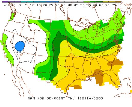
Here are the dew points progged for Thursday morning:
And here are the forecast for PA for Thursday morning with the map of  morning lows.  That will feel quite refreshing!
The weekend and points beyond look to be more of the same repetitive pattern.  Although this weekend, I do believe there is a chance of a cloudy dreary weekend with a stiff onshore easterly wind that would lead to overcast skies and temps in the 70s. 

As for precip, there is a chance of a stray storm this afternoon, but not a widespread event.  In fact, most people will see nary a drop of rain through the remainder of the week.  The rain will be kept to our south over the next week as the map below shows!  This is the total precip through next Wednesday.  That train of rain suggests an on shore flow from the Atlantic at our latitude.  Just a thought....
In closing, the ongoing drought in the south-central and SW portion of the US is not expected to end any time soon. The NWS recently predicted that severe drought conditions will continue in Texas and Oklahoma through this year and into 2012. In order to escape the drought sooner, the region will need a few tropical systems to spread desperately needed rain to the area. The most recent US Drought Monitor report as shown below indicates that over 71% of the state is in the exceptional drought level, which is the worst drought level. The July 5 data can be seen below.  New Mexico is marginally better(~41% exceptional drought) as is OK....where in terms of water at present, Oklahoma is not OK!

Enjoy your MLB all-star (sort of) game Tuesday evening....

Smitty

AA:  Hot & humid Tuesday, warm and drier Wednesday, refreshing Thursday and Friday....might be a cloudy dreary weekend...might?  Not sold on that one yet.....Go National League!


Sunday, July 10, 2011

5 For 5 For 3003 Including GW RBI

It really can't be scripted any better than it actually played out!  Derek Jeter earned his Hall of Fame plaque yesterday with a Home Run to left field around 2 pm EDT in the afternoon.  But he didn't stop there!  Oh, no!  He continued on his hit parade by completing the day going a perfect 5 for 5; the 1st player in the new Yankee Stadium to accomplish this feat.  And now, we have this graphic below to show us exactly in what company Jeter now belongs.  What a day for the Yankees and what a day for MLB!  Jetes is the man!  (Please note the hit total out from Jeter is now 3003!)
Now onto the weather....and the operative word for this week will be "heat".  Here in PA, we will only get a small taste of the heat that is building out over the plains states.  Illinois and Missouri look to be the states that will have the highest heat index (coupled with insanely high humidity!) but OK and TX look to be the areas with the highest absolute temps along with the deserts of CA, AZ, and NV.  But, this beautiful Sunday morning dawns bright and dry as our dew points will remain in check today compliments of a big Canadian high pressure system that is over northern PA as I type.  Temps are around 50F this am in northern PA with dew points in the 40s!  The map sequence below shows how the humidity will increase Sunday through Tuesday...First Sunday afternoon...note the dry air holding in the NE.
 By Monday afternoon, humidity here in PA is not yet oppressive, but it is certainly increasing.  Look at the ugly dew points in the middle part of the country.
But by Tuesday morning, most of the eastern US is entrenched in humid air.  But look at the dry air poised to move SE for the 2nd part of the week.  By Wed and most certainly Thursday, the weather here in the NE will be beautiful again compliments of the 1020 mb high pressure system as shown in the map below.
Here is the surface prog for Thursday.  Beautiful weather warning for PA!
So get through the humidity that will increase Monday in be here fully Tuesday allowing storms to pop Tuesday afternoon and evening, then beautiful weather awaits us for the end of the week.  Only the caustic rhetoric from DC will ruin the nice weather that will invade the eastern US Wednesday and last through Friday and possibly Saturday.  I wonder if this country will ever get its finances corrected?
Have a great Sunday!

Smitty

AA:  Jeter is the man!  Also, hot and humid Monday and Tuesday; today should be fine....just very warm.  Then front will pass Tuesday pm giving us showers/storms and nice weather to end out the week.