This is what I call roller coaster weather, that is nice then yucky then nice then yucky. That is compliments to yet again a fairly zonal west to east jet stream that allows for the changing of air masses on a rather regular basis. But it is summer and that jet will pull further north keeping us in the "stickys" once our next cool and dry shot comes through Wed-Thurs of next week. Below is the water vapor image that shows our nice Sat-Sun and our frontal passage Tuesday afternoon bringing in nice O Canada air for the middle and end of next week.

The dark area over the eastern lakes and PA this morning (Red area) clearly shows dry air in the mid and upper levels. Hence, as I am typing this I see no clouds this beautiful Saturday morning. On my morning jaunt, I certainly felt the air have a slightly drier quality as I my T-shirt was only 3/4 saturated as opposed to completely saturated earlier in the week. Now, it will still get warm today and most certainly Sunday, but the humidity should remain in check until late Sunday when the air begins to invade from the SW as shown by the green arrow above. Not only will this spike the heat, it will most certainly spike the humidity as well. The 500 mb prog for Monday shows the heat ridge building towards us for Monday and early Tuesday until the cold front invades from the northern plains.

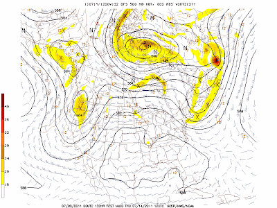
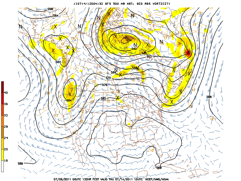
As you can see above, the 588 mb height is north of PA which suggests temps will be quite warm for Sunday afternoon and Monday afternoon as well. The real heat this week will be centered over MO, AR, OK, and KS where 100+ heat will be easily attained. But by Thursday, look how the 500 mb level has evolved. A rather strong front has squashed the 500 mb heights way down indicating cooler and drier weather for Wed-Thursday. Note how the 594mb height has disappeared from the central US. Oh, it will still be hot, but not as torrid as earlier in the week. A refreshing NW flow at the mid-levels for us will lead to a nice couple of days for mid July.
But, sure enough, the heat will return as shown by the ensembles for Monday, July 18. The greatest anomaly is over the Great Lake states, but that is when we here in Harrisburg can also have some very hot temps as the winds downslope from the Appalachians and the air that is downsloping, warming, and compressing is already flippin' hot to begin with! I look for our hottest (in absolute terms, not heat index with the humidity) weather of the summer the week of July 18. That's not really any surprise since climatologically this is when we have our hottest weather at KMDT. The Euro is on the left; the GFS on the right. Note yet again a trough very near us and the persistent NW flow at the mid-levels. We've been in this pattern since the 2nd week of June!

In closing, I have a brief survey for y'all to take if you'd be so kind. Of course it has to do with Derek Jeter and his 3,000th hit. So, please indulge me and log onto the link and take survey. For my technologically challenged friends, acquaintances, and readers,...just bag it, it's not worth the hassle or frustration.
http://www.surveymonkey.com/s/29ZDXZ9
As for the weather; enjoy this nice but warm-hot respite from the humidity today and Sunday for it will be coming back in spades before the mid-week break or refreshing air invades from O Canada!
Happy week's end!
Smitty
AA: Nice warm/hot weekend but with less humidity. Hot & Humid for Monday and Tuesday until the front comes through with some possibly hefty storms Tuesday pm. Nice and refreshing Wed-Thursday.


No comments:
Post a Comment