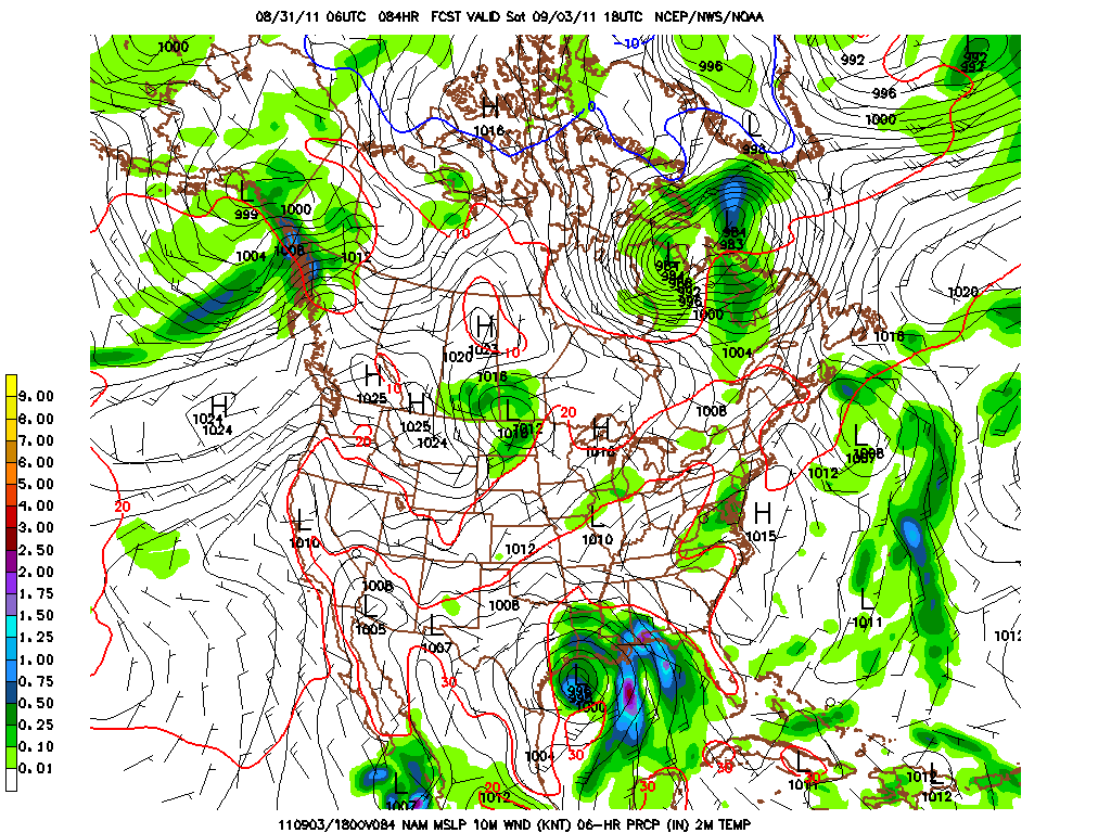
Just a very brief update as to what is occurring over the eastern part of the US the next several days. Below is the NAM showing what should be listed as a tropical depression within the next 24 hours. This disturbance will become better organized and eventually turn into a tropical storm or even a low cat hurricane. The graphic below is for Saturday afternoon. Note the precip over PA at that time as well.
Here is the GFS for 36 hours later. This wider view shows not only the gulf storm a bit further east and weaker, but it shows the powerful hurricane Katia looming just off the south Atlantic coast. Most of the modeling to this point recurves Katia before she hits the east coast. It is waaay toooo early to buy that solution! Keep a wary eye on this potentially nasty east coast storm!
The last graphic shows the potential snafu for this first week of the 2011 version of Friday night lights. As the WRF shows, there is most certainly a patch of unsettled weather located over the commonwealth. As to where this precip will end up in the early evening of Friday night, again this is too early to determine as there is really no catalyst to create any true dynamics and get better organized as opposed to receiving just a smattering of showers over a 24-48 hours period centering on this weekend.
Best I can do at this time......pressed for time and computer issues......
Have a good mid-week!
Smitty
AA: Gulf hurricane this weekend and an east coast hurricane after Labor Day? Might get wet in the lift Friday night, but I'm not sold on that yet!


No comments:
Post a Comment