First the Euro landfall next Thursday pm...

And the GFS landfall...a tad quicker and a bit weaker (barely!)...
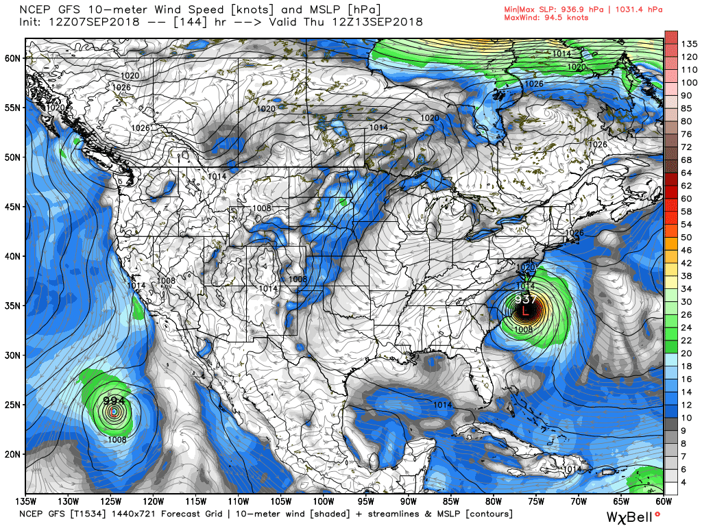
Both have textbook synoptic set ups...you can see the paths based on precip totals...first the GFS...

You can see the path of Flo from the tropical Atlantic far off the coast of FLA moving WNW and moving up the spine of the Appalachians...the other heavy rain swath is from Gordon from St Louis to Bangor, Maine! The mid-Atlantic needs NO MORE RAIN this summer!
Here is the Euro's take...very similar with a disaster for the central Appalachians in terms of flooding rains! But the 2 global models are slowly beginning to agree on a solution for this tropical menace...

And before all of this, the east coast looks to be under the gun this weekend with a gale from a stalled frontal system...take a look; first winds. Those are some serious onshore winds later Sunday for the Delmarva and Jersey coasts...

And the subsequent wave heights. The map below indicates maximum wave heights for Sunday pm...that will be quite a pre-Flo pounding of the east coast and certainly NOT what the doctor ordered!

OK...for my loyal readers, I'll keep y'all posted. But I am concerned for late next week as Flo looks to mean business! Just a week out is waaaaaay toooooo far out to have much certainty, but when the GFS has now come on board with the consistent Euro, confidence is growing for a major hurricane to affect the east coast late next week sorry to say.
Enjoy this (which the Tide will most certainly be high on few occasions the next several days!) and enjoy your weekend!
Smitty
AA: Concerned that a tropical system will deliver more flooding rains to our region or at the very least within 200 miles of our area sorry to say. A 1-2" rainy weekend as well...
No comments:
Post a Comment