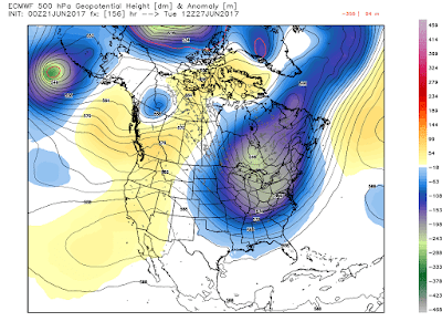
First the Euro...
Next the GFS...
And the final global model I'll share is the O'Canadian...
And the smaller gridded NAM...
So, it looks as if there will be some rain, but just how much is still a roll of the dice as of now. Gut feeling deep moisture with approaching height falls that may lead to record coolness early next week, I believe we are looking at at least 0.50" with 1.5" not out of the question. Time will tell...Here are all of the plots as of today with the track of the storm...
And here is how deep this trough will be at its greatest deviation from norms next week (Tuesday)...that is quite the trough for this time of year!
OK...back to more computer work here at school. I just took my lunch to study this system and share some of the numerical guidance with my faithful readers (after a beautiful stroll outside in this glorious sunshine)! So, with that said, I'll leave y'all with a Merle Haggard classic...enjoy!
Smitty


Great stuff Denny!
ReplyDeleteThanks for reading!
Delete