Smitty's attempt to educate and to a much lesser extent, entertain, about all facets of life; but primarily the meteorological and the climatological aspects of the earth sciences.
Tuesday, September 29, 2015
Finally, Something to Talk About
After what has been a seemingly endless stretch of beautiful fall weather, this week will bring copious amounts of liquid sunshine and possibly a visitor from the deep tropics. This will be quite brief and I will show you the extreme (not necessarily the outlier) solutions numerically. First the stage is set with the late Tuesday pm water vapor loop...
Note the THREE tropical systems over the Atlantic...this really is complicating the modeling as the spread is incredible this late in the game! Take a look...(Not liking that NGXI (Navy) model!)...as it looks to take the storm to Hudson Bay prior to it freezing for the winter!
However these systems decide to render their interaction and feedback with each other, both global models kick out a tremendous amount of precip by the end of this upcoming weekend...here is the GFS' take on total precip!
The Euro a tad further south with its bulls-eye...
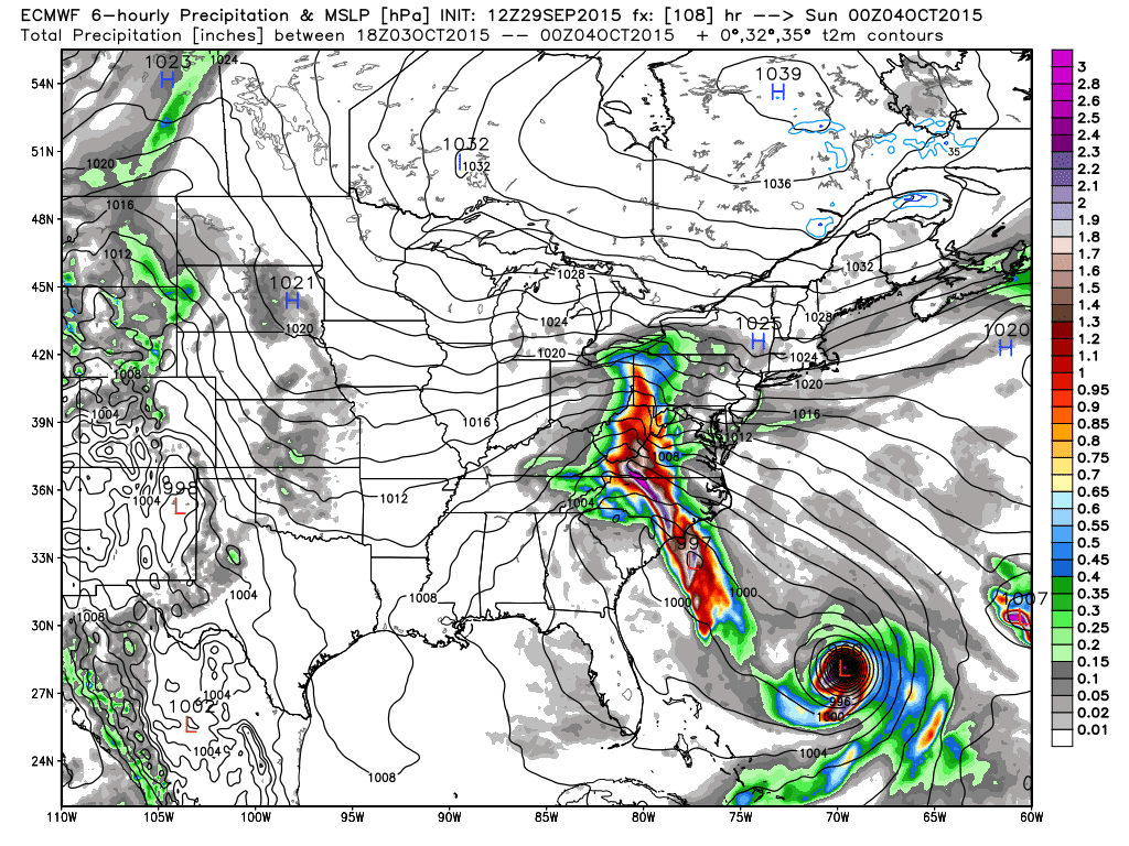
The Euro takes the tropical weather out with the warmer Gulf Stream but has an inverted trough streaming moisture up along the spine of the Appalachians this weekend...
Whereas the US modeling has an ugly solution for the east coast!
Time will tell; the NHC is favoring the global solutions; namely the Euro and keeps the center of Joaquin well offshore but allows for much rain to affect the eastern seaboard. Joaquin...lets hope this storm is not as impactful as this 2 time 20 game winning all-star MLB pitcher, Joaquin Andujar...RIP...
OK...I'm out. I will leave you with a favorite of mine from Jackson Browne...enjoy and stay dry!
Smitty
AA: Lots of rain this week; might actually have a land falling tropical system Friday-Saturday time frame, but I don't believe so...just wet persists through the weekend.


No comments:
Post a Comment