And a secondary shot of autumn to be felt in these parts later in the week...say about Friday...
But later in the medium range, the heat from the southern plains is threatening to return...here, the Euro shows a broad SW flow advecting heat and humidity towards PA. In addition, if there are any tropical troubles, and there very well may be, this pattern allows for a tropical system to move along the Appalachians up towards these parts beginning any time from this weekend on...
Here is the NAM tropical wind swath suggesting the potential for a storm to be moving towards FL by late in the weekend...I don't really but this solution, however...
O Canada keeps this potential well off to the N and E of the CONUS...albeit, a formidable storm nonetheless...
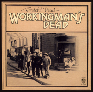
So on this Labor Day, 2013, the final day of summer as viewed from an historic point of view, we enjoyed late season heat and humidity. However, as we progress deeper into September, most notably this week, cooler and much drier wx will become the served up on the wx menu. With that said, let me leave you with one of my favs off an album released in 1970 with an appropriate title for today...
...and here is that tune...from a live version album (Europe '72).
Enjoy your Tuesday and the beginning of your WORK WEEK...for most of you reading this...
Smitty
AA: Cooler and drier this week. Warmer air returns next week. Still watching the tropics and listening to good tunes.


No comments:
Post a Comment