Although the modeling has been anything but consistent in the timing of a major event next weekend or late in the week, it has been very adamant about a MAJOR system forming as a result of yet another major trough amplification here into the east. What I'd like to show y'all is the timing differences of the GFS all progged for the same time next Saturday morning. The 1st map is from yesterday's 06Z run, the last is the latest 00Z run. Here goes.....
06Z Run
12Z Run
18Z Run
00Z Run
Believe me on this as I cannot access the prior runs, but the 00Z run from Friday had a major nor'easter complete with PA mountain snows up through New England! This latest run is a bit more phased bringing in warm ocean air from the Atlantic.
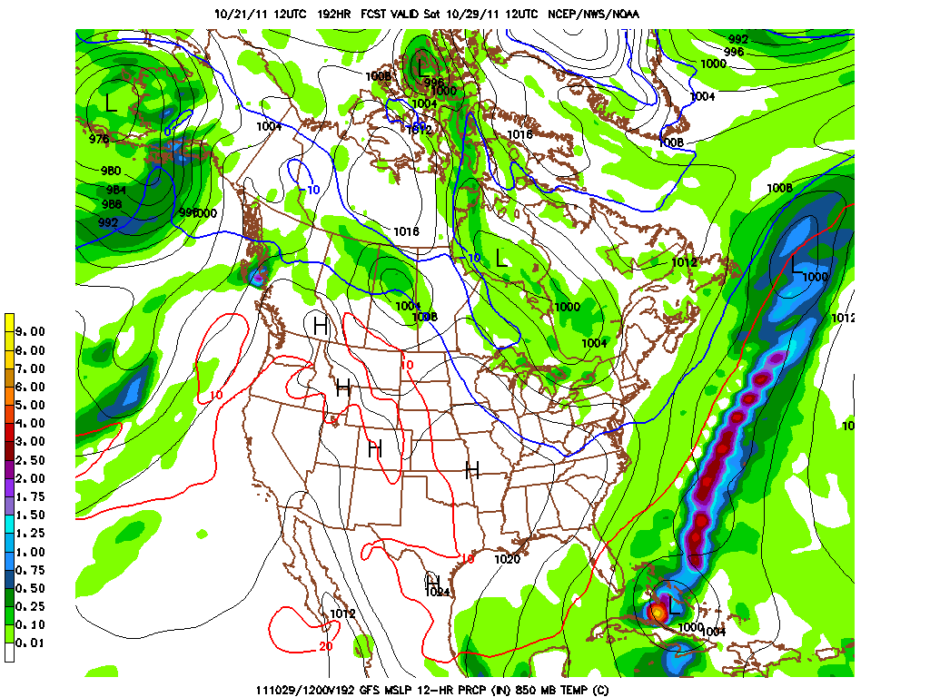
Either case, there is plenty of energy and cold air that must be resolved for next weekend! Whether it be during Friday Night Lights, Trick or Treat Night, or the last weekend in October, someone in the eastern mountains WILL see their first real snows of the season....I do believe that. And it could be as close to us as the higher elevations of Center and Union Counties of central PA. Here are the coldest progged 850 temps for next weekend....cold! Those 1 mile up temps translate to temps in the upper 30s and low 40s here in our area and near freezing for the mountains of PA! But look west of the purple and note the flood of mild Pacific origin air across O Canada. This slap of cold will be a transient shot as the pattern is still quite progressive.
By the way here is the Euro's take on next weekend! First the 850 storm location...man if this were January I'd be licking my chops and touting a crippling blizzard-cane for Harrisburg!
And the 850 mb temps a short time after this storm passes us, but New England gets pounded with a heavy wet snow! I know...I know...who cares about New England! Well my buddy Myers loves NE as do I (I'm partial to Maine, personally....interior over downeast), but his natural white carpet might get an early season start for Halloween weekend!
And of course, here is the infamous Woolly Bear's Take on next week's wx!
As for me I'm partial to the groundhog....PA's in particular!
And a final shout-out...not to any prognosticator, but to the 2011 Mid-Penn Conference Field Hockey Champion the CD Lady Rams! In an extremely entertaining game that featured long breakaways, disallowed goals, a captain conference with officials, and OT, the Lady Rams defeated their nemesis (and everybody's for that matter), the perennially talented and outstanding LD Lady Falcon team by a 1-0 margin. Congrats to the coaches and the players who earned their medals in a most exciting contest!
Have a great week's end!
Smitty
AA: Major wx event sometime late next week or weekend. Snow will fly nearby to the north, but not in our area...yet. Then the coldest air yet with blustery winds. But the cold will not hold as mild air will then erode the cold. I consulted with my furry friends for this! Also, congrats to the CDHS FHK team on their Mid-Penn Conference Championship!


No comments:
Post a Comment